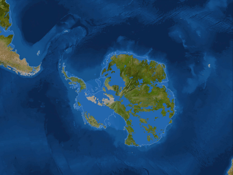
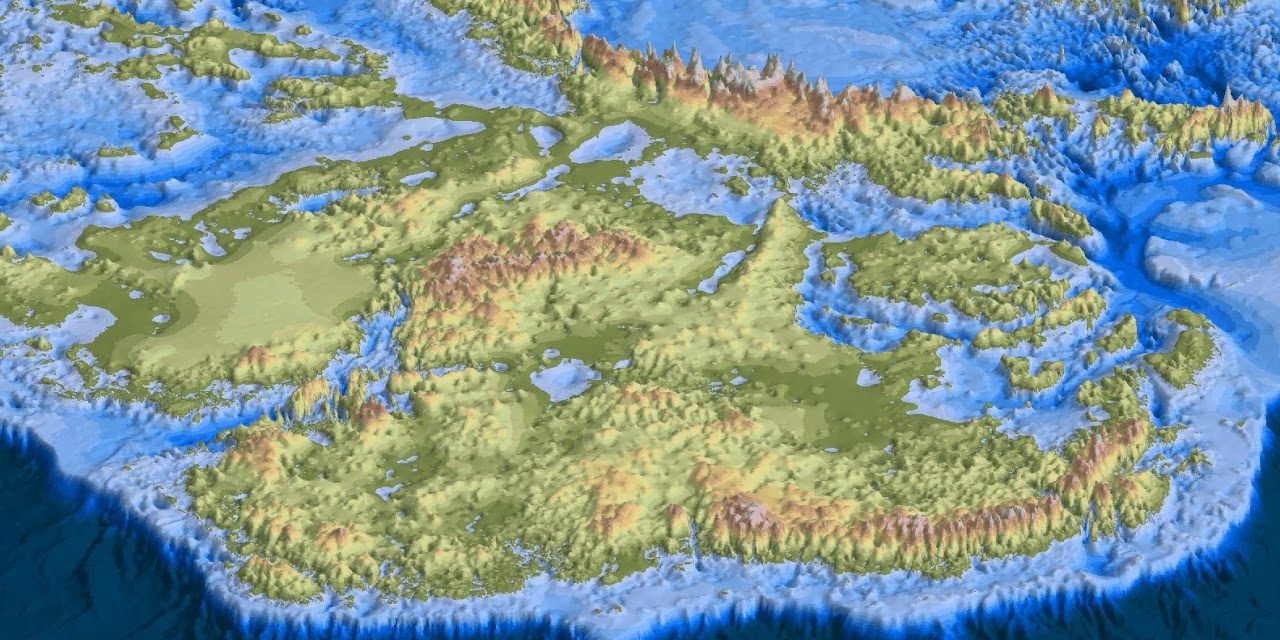
The icebound, snowy wastes of Antarctica remain one of the most hostile environments for terrestrial animals, however our southernmost continent has not always been such a cold, inhospitable landmass. In the past, dinosaurs roamed its lush polar forests and even after the extinction of the non-avian dinosaurs, Antarctica continued to remain largely unfrozen for tens of millions of years into the Cenozoic. Antarctica without ice was reality in the past.
Antarctica was a big rain forest covered in tree ferns. Ice overtook the continent between 50 and 34 million years ago. Scientists are still debating why that happened.
About 34 million years ago, Tasmania and South America broke away from Antarctica, leaving the continent isolated. That kick-started what’s called the Antarctic Circumpolar Current — a vast current of cold waters that walled the continent off from more tropical heat.
However, the most intriguing time — the period that matters most to us today — scientists hope to explore in the rock record is between 7 and 14 million years ago. It’s a period geologists call the Miocene. Earth’s temperature and atmospheric CO2 levels were similar to what we’re experiencing today, and yet Antarctica was going through significant changes.
Antarctica today is divided into three regions: East Antarctica, West Antarctica and the Antarctic Peninsula, with each section comprising a different topography beneath. The ice of the Antarctic Peninsula, for example, hides a spine of mountains projecting northwest from the inside of the continent.
East Antarctica, the largest sector, includes some flatter plains as well as mountains. Here, the Gamburtsev Mountain Range — spanning 750 miles with peaks topping 11,200 feet — is about the same size as the European Alps, and completely covered by more than 2,000 feet of ice.
West Antarctica’s ground is almost entirely below sea level. The ocean bowl under the region was created during the last ice age, when the weight of the ice, much thicker at the time, pressed down on the bedrock.
The lack of landmass under West Antarctica makes the region more vulnerable to melting, as it lacks the mountain ridges that stabilize the glaciers in the east. Satellite data collected between 1996 and 2006 showed that the thinning of the ice shelves (floating sheets of ice that connect to a landmass) stagnated in East Antarctica, while in West Antarctica, the rate of the melting tripled.
There are two massive ice sheets covering Antarctica. They cover the vast majority of the landmass with only 2.4% of it free of ice (called Antarctic Oasis). They cover an area of around 14 million square kilometers.
It’s difficult to comprehend just how thick the ice sheets are. They average 2,160 meters thick and have a maximum depth of 4,776. To put that in context, Mount Mitchell (the highest peak in the Appalachians) is only 2,037 meters high above sea level. While Mount Elbert is the highest mountain in the Rockies at 4,401 meters.
That made Antarctica the highest continent in the world by far. This ice accounts for over 90% of the world’s ice and 70% of all the world’s freshwater. See below what Antarctica without ice looked like. Like stories about Antarctica? Have you read the new book by Daniel River yet? It is a mystery thriller called Arctic Ave. Available now on Amazon and Barnes & Noble.


1 Comment